Ahead of a big travel weekend, some parts of the tri-state are going to see their first snowflakes of the season later this week.
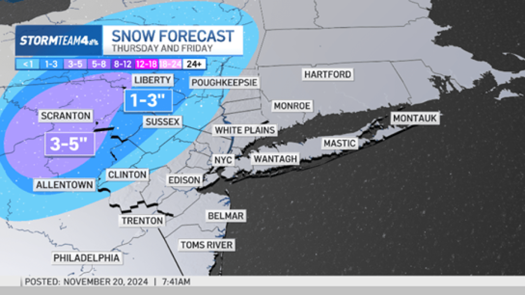
If you live north and west of New York City, accumulating snow is possible Thursday into Friday.
A winter weather advisory has been issued for Sullivan and western Ulster counties in New York and Pike County in Pennsylvania.
A winter storm watch will be in place for Carbon and Monroe counties from 4 p.m. Thursday into 4 p.m. Friday.
Who will get snow this week?
We want to be clear, the most likely chance for accumulating show is in areas north and west of the city at the highest elevations.
For the immediate New York City metro area, most residents will see heavy rain.
Snow is the high elevation areas of Pike, Sullivan, western Ulster, and northwestern New Jersey, and areas further north and west are most likely to see snow.
When will the snow start?
Snow is these areas of Pike, Sullivan, western Ulster, and northwestern New Jersey could start as early as Thursday evening and continue through Friday morning.
How much snow will we get?
Snow accumulations of a trace to five inches will be what most in higher elevations could see.
The highest elevations north and west of the city could see accumulations of six to eight inches of snow by the time the storm moves out Friday.

Temperatures are expected to hover around 40 degrees Friday morning, but straddle the freezing mark in those higher elevations.


