The first half of September has been dry. Only one day has produced measurable rainfall in Central Park, totaling less than a quarter inch so far for the month.
But this sunny and dry streak will come to an end, thanks to a low-pressure system headed our way.
So far this week has been dry, and we’ll stay rain-free through Tuesday, with high temperatures in the mid to upper 70s. Despite mostly cloudy skies, outdoor plans will be unencumbered by weather, so get outside and enjoy; the umbrella can stay at home.

Even Wednesday will be mostly dry. No windshield wipers will be needed for the early drive, but the same cannot be said for the evening commute.
Scattered showers start to push into the area by the afternoon and continue into the evening and night. Rain will not be constant, but you’ll want to have an umbrella handy if you plan on being out; you don’t want to get caught in an isolated downpour.

Spotty shower chances linger into Thursday and even a few sprinkles could be around on Friday. You’ll want to keep the rain gear close by through the end of the week to be safe.

The track of this approaching offshore low has been trending increasingly east and farther from us. The farther east it shifts, the less rain we can expect in our area.
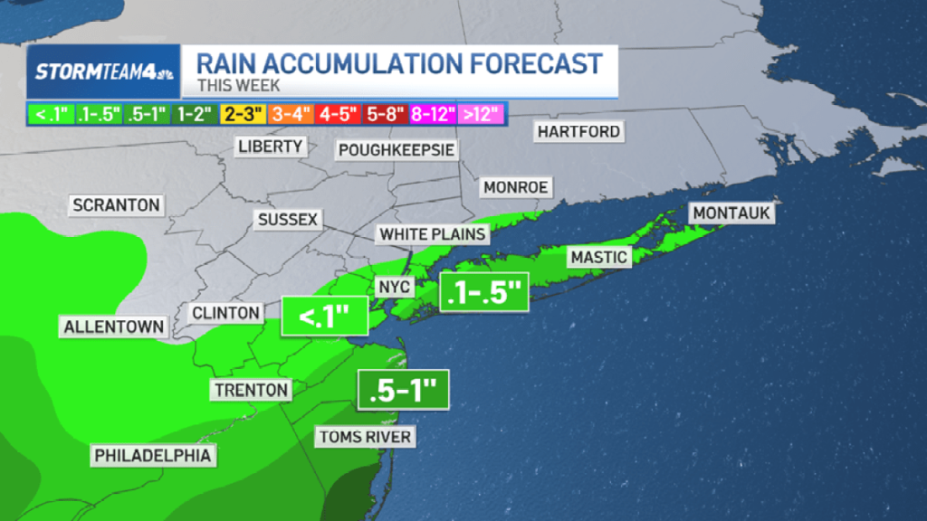
Right now, the greatest rain totals stay confined to the coasts of New Jersey and Long Island, with totals sharply diminishing further inland. Most of New Jersey and the City will get less than half an inch, while the Hudson Valley looks even drier with most seeing less than a tenth of an inch, if that.

But the high concentration of showers down the shore is much needed.
The lack of rainfall across the tri-state this month has left parts of Central and South Jersey in the “abnormally dry” category on the drought monitor. So even though it means an end to our sunny and dry weather, rain returning to the area, especially in a modest amount, will be a good thing.

Along with the rain, the coastal low will bring a gusty easterly wind along the shorelines. This will contribute to a high risk of dangerous rip currents beginning Tuesday.
The onshore flow also coincides with Tuesday’s full moon, increasing the chance for some minor coastal flooding.

Skies dry out significantly heading into the weekend, in time for the official start of Autumn on Sunday. And temperatures are going to feel like it.


